WebView를 활용하여 간단한 예제를 만들어 보았다.
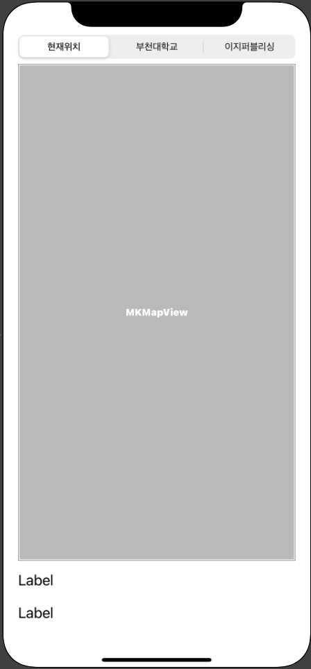
스토리보드 구성
오브잭트 옵션
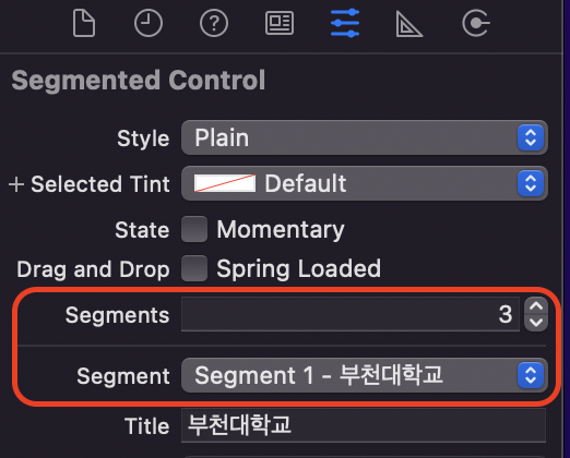
상단에 배치한 Segment Control의 옵션이다. 세그먼트의 갯수를 3개로 늘리고, 세그먼트의 타이틀을 수정하였다.
추가 옵션
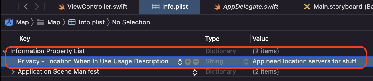
위치정보를 받아오는 것을 허락받기 위한 옵션이다. 설정하면 어플 실행 시 위치정보 이용을 허락할지 수락받는 옵션이 뜬다.
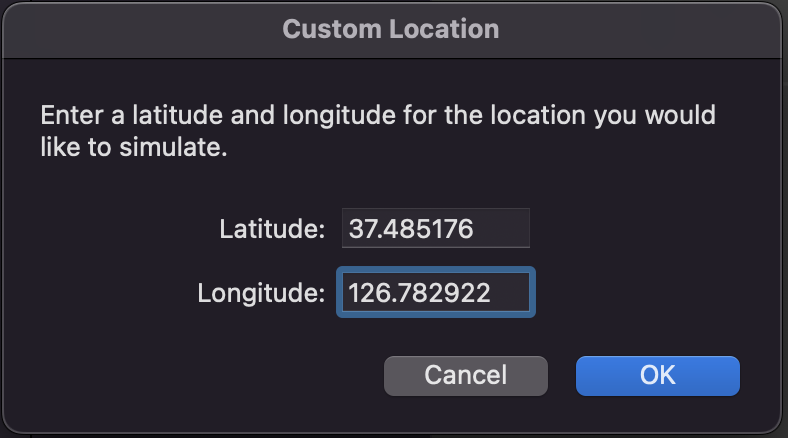
시뮬레이션의 옵션에서 기본 위치정보를 지정하기 위한 옵션이다. Features -> Location -> Custom Location을 선택하고, 원하는 기본 위치의 위도와 경도를 적으면 설정이 가능하다.
코드
import UIKit
import MapKit
class ViewController: UIViewController,CLLocationManagerDelegate {
@IBOutlet var myMap: MKMapView!
@IBOutlet var lblLocationInfo1: UILabel!
@IBOutlet var lblLocationInfo2: UILabel!
let locationManager = CLLocationManager()
override func viewDidLoad() {
super.viewDidLoad()
// Do any additional setup after loading the view.
lblLocationInfo1.text = ""
lblLocationInfo2.text = ""
locationManager.delegate = self
locationManager.desiredAccuracy = kCLLocationAccuracyBest //정확도를 최고로 설정
locationManager.requestWhenInUseAuthorization() //위치 데이터를 추적하기 위해 사용자 요구
locationManager.startUpdatingLocation() //위치 업데이트 시작
myMap.showsUserLocation = true
}
func goLocation(latitudeValue: CLLocationDegrees, longitudeValue : CLLocationDegrees, delta span :Double) -> CLLocationCoordinate2D {
let pLocation = CLLocationCoordinate2DMake(latitudeValue, longitudeValue)
let spanValue = MKCoordinateSpan(latitudeDelta: span, longitudeDelta: span)
let pRegion = MKCoordinateRegion(center: pLocation, span: spanValue)
myMap.setRegion(pRegion, animated: true)
return pLocation
}
//특정 위도와 경도에 핀 설치하고, 핀에 타이틀과 서브 타이틀의 문자열 표시
func setAnnotation(latitudeValue: CLLocationDegrees, longitudeValue : CLLocationDegrees, delta span :Double, title strTitle : String, subtitle strSubtitle:String) {
let annotation = MKPointAnnotation()
annotation.coordinate = goLocation(latitudeValue: latitudeValue, longitudeValue: longitudeValue, delta: span)
annotation.title = strTitle
annotation.subtitle = strSubtitle
myMap.addAnnotation(annotation)
}
//위치 정보에서 국가, 지역, 도로를 추출하여 레이블에 표시
func locationManager(_ manager: CLLocationManager, didUpdateLocations locations: [CLLocation]) {
let pLocation = locations.last
_ = goLocation(latitudeValue: (pLocation?.coordinate.latitude)!,
longitudeValue: (pLocation?.coordinate.longitude)!, delta: 0.01)
CLGeocoder().reverseGeocodeLocation(pLocation!, completionHandler: {
(placemarks, error) -> Void in
let pm = placemarks!.first
let country = pm!.country
var address:String = country!
if pm!.locality != nil {
address += ""
address += pm!.locality!
}
if pm!.thoroughfare != nil {
address += ""
address += pm!.thoroughfare!
}
self.lblLocationInfo1.text = "현재 위치"
self.lblLocationInfo2.text = address
})
locationManager.stopUpdatingLocation()
}
//세그먼트 컨트롤을 선택하였을 때 호출
@IBAction func sgChangeLocation(_ sender: UISegmentedControl) {
if sender.selectedSegmentIndex == 0{
//"현재 위치" 선택 - 현재 위치 표시
self.lblLocationInfo1.text = ""
self.lblLocationInfo2.text = ""
locationManager.startUpdatingLocation()
} else if sender.selectedSegmentIndex == 1{
//"부천대학" 선택 - 핀을 설치하고 위치 정보 표시
setAnnotation(latitudeValue: 37.489493, longitudeValue: 126.778669, delta: 0.01, title: "부천대학교 본캠퍼스", subtitle:"경기도 부천시 신흥로56번길 25")
self.lblLocationInfo1.text = "보고 있는 위치"
self.lblLocationInfo2.text = "부천대학교 본캠퍼스"
} else {
//"이지퍼블리싱" 선택 - 핀을 설치하고 위치 정보 표시
setAnnotation(latitudeValue: 37.556876, longitudeValue: 126.914066, delta: 0.01, title: "이지퍼블리싱", subtitle: "서울시 마포수 잔다리로 109 이지스 빌딩")
self.lblLocationInfo1.text = "보고 있는 위치"
self.lblLocationInfo2.text = "이지퍼블리싱 출판사"
}
}
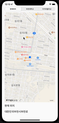
}실행 결과

오늘도 조금씩 성장하자