PX4 HILS
방법
cd <Firmware_clone>
DONT_RUN=1 make px4_sitl_default gazebo-classic
source Tools/simulation/gazebo-classic/setup_gazebo.bash $(pwd) $(pwd)/build/px4_sitl_default
gazebo Tools/simulation/gazebo-classic/sitl_gazebo-classic/worlds/hitl_iris.world
Problem1. unsupported estimator_type8
[21:11:05.994] Error: ODOMETRY: unsupported estimator_type 8
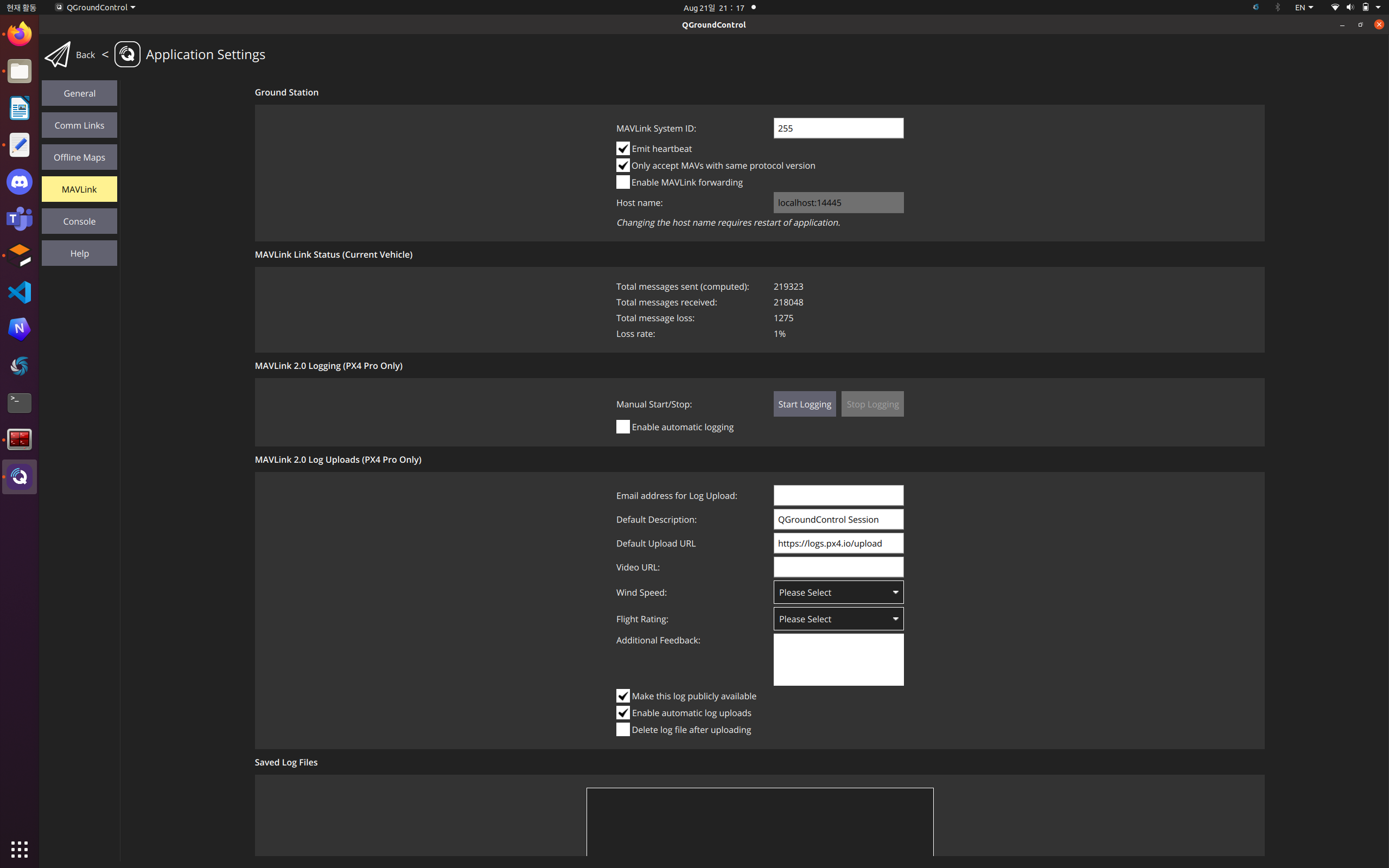
solve : 이 사진에서 Enable MAVLink forwarding 꺼야함
Problem2. TX queue overflow
이건 mavlink의 데이터 전송속도가 너무 높아서 그럼. 이는 mav_1_rate가 1200B/s로 되어있을텐데 이를 600B/s정도로 낮추면 됨
항상 hitl model 파일에서 buadrate를 921600로 변경하면 됨
좌표 변경
export PX4_HOME_LAT=37.3842976
export PX4_HOME_LON=126.6545329
export PX4_HOME_ALT=35
이후 DONT_RUN1 부터 다시 : 송도
export PX4_HOME_LAT=36.6609392
export PX4_HOME_LON=126.3419253
export PX4_HOME_ALT=0 : 태안 UV랜드
export PX4_HOME_LAT=37.4166645
export PX4_HOME_LON=126.6126908
export PX4_HOME_ALT=0 : 미송중
이거 해봤자 자꾸 폴란드에서 흘러감.
이걸 sun을 include하는 곳 밑,
<physics name='default_physics' default='0' type='ode'>위에 넣으면 됨
<spherical_coordinates>
  <surface_model>EARTH_WGS84</surface_model>
  <latitude_deg>36.6609392</latitude_deg>
  <longitude_deg>126.3419253</longitude_deg>
  <elevation>0</elevation>
</spherical_coordinates>
참고로 이 좌표는 태안UV랜드임.
<spherical_coordinates>
  	<surface_model>EARTH_WGS84</surface_model>
  	<latitude_deg>37.3842976</latitude_deg>
  	<longitude_deg>126.6545329</longitude_deg>
  	<elevation>0</elevation>
</spherical_coordinates>
이 좌표는 송도 좌표.
이걸 iris_hitl.world에 넣어주거나 혹은 standard_vtol_hitl.world에 넣어주셈.
그러고 픽스호크를 QGC연결된 컴퓨터에서 뺐다가 끼고 다시 hitl 명령어를 실행하면 됨.