🔑Summarization
Python package - folium Basic
📗Contents
- 설치
pip install folium- 사용방법
import folium

m = folium.Map(location = [45.5236, -122.6750])
m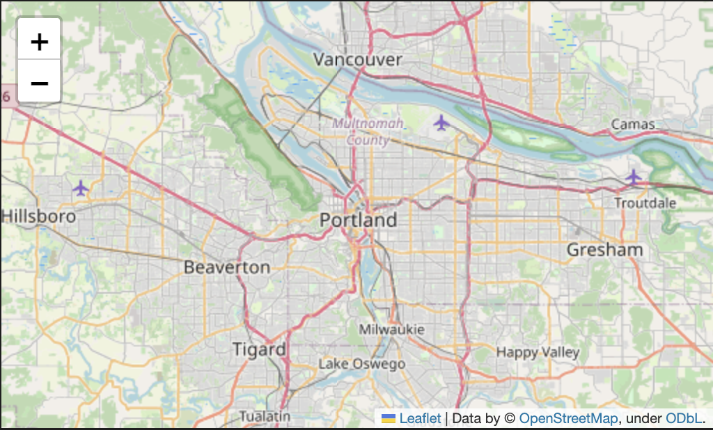
- Save Path : HTML 파일로 저장 가능
m = folium.Map(location = [45.5236, -122.6750])
m.save('index.html') # HTML 저장 가능
Tile option
- tile : 지도 스타일 지정
- zoom_start : 시작배율 설정
folium.Map(location=[45.5236, -122.6750], tiles='Stamen Toner', zoom_start=13)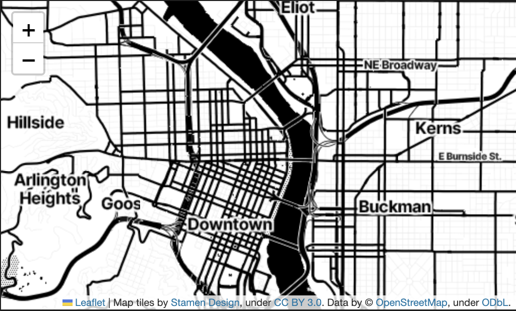
folium.Marker()
- 지도에 마커 생성
my_map = folium.Map(location=[45.372, -121.6972], zoom_start=12, tiles='Stamen Terrain')

# 마커 추가 가능
folium.Marker([45.3288, -121.6625], popup='<i>Mt. Hood Meadows</i>').add_to(my_map)
folium.Marker([45.3311, -121.7113], popup='<b>Timberline Lodge</b>').add_to(my_map) # popup : 마커에 표시되는 글귀

my_map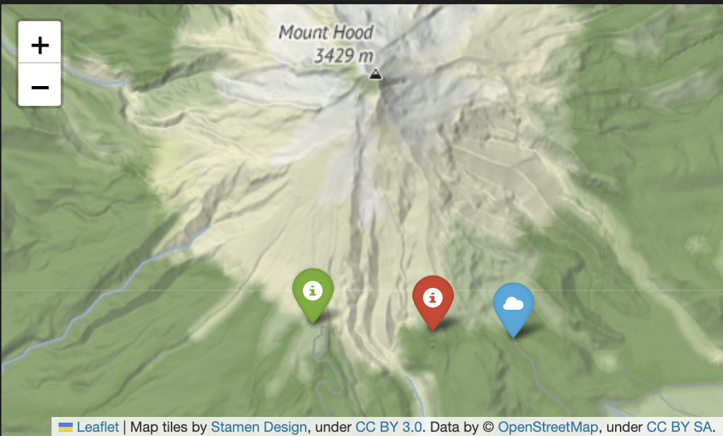
folium.ClickForMarker()
- 지도 위에 마우스로 클릭했을 때 마커를 생성
m = folium.Map(
    location = [37.544564958079896, 127.05582307754338],
    zoom_start = 14,
    tiles = 'OpenStreetMap'
    )

m.add_child(folium.ClickForMarker(popup = 'ClickForMaker'))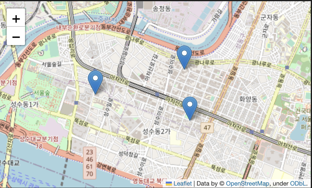
folium.LatLngPopup()
- 지도를 마우스로 클릭했을 때 위도/경도 정보를 반환
m = folium.Map(
    location = [37.544564958079896, 127.05582307754338],
    zoom_start = 14,
    tiles = 'OpenStreetMap'
    )

m.add_child(folium.LatLngPopup())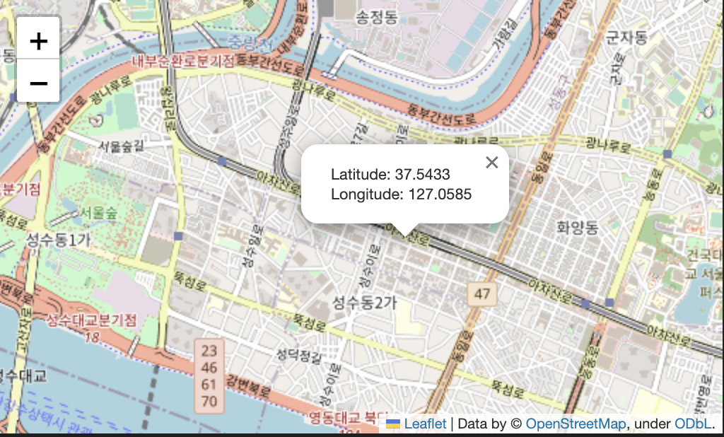
folium.Circle(), folium.CircleMarker()
folium.Circle(): 좌표에 원을 이용해 표시folium.CircleMarker(): 좌표에 원을 이용해 표시
※ 둘 간의 차이점
1. folium.CircleMarker()는 배율에 따라 Circle의 radius가 자동 조정 됨
2. 그 외 옵션은 모두 동일
# Circle Marker

m = folium.Map(location=[45.5236, -122.6750], zoom_start = 13, tiles = 'Stamen Terrain')

# 마커 추가 가능
folium.Circle(
    radius = 100,
    location = [45.5244, -122.6699],
    popup = 'The Waterfront',
    color = 'crimson',
    fill = False
).add_to(m)

folium.Circle(
    radius = 50,
    location = [45.5215, -122.6261],
    popup = 'Laurelhurst Park',
    color = '#3186cc',
    fill = True,
    fill_color = '#3186cc'
).add_to(m)

m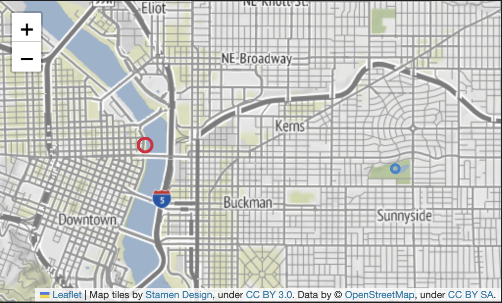
다양한 옵션들
folium.Circle() / folium.CircleMarker()
m = folium.Map(
    location = [37.544564958079896, 127.05582307754338],
    zoom_start = 14,
    tiles = 'OpenStreetMap'
)

# circle
folium.Circle(
    location = [37.555243442409406, 127.04370422643919],
    radius = 100,
    fill = True,
    color = '#eb9e34',
    fill_color = 'red',
    popup = 'circle popup',
    tooltip = 'circle tooltip'
).add_to(m)

# circle marker
folium.CircleMarker(
    location = [37.54347089498245, 127.04439204503],
    radius = 100,
    fill = True,
    color = '#34ebc6',
    fill_color = '#c634eb',
    popup = 'circleMarker popup',
    tooltip = 'circleMarker tooltip'
).add_to(m)

m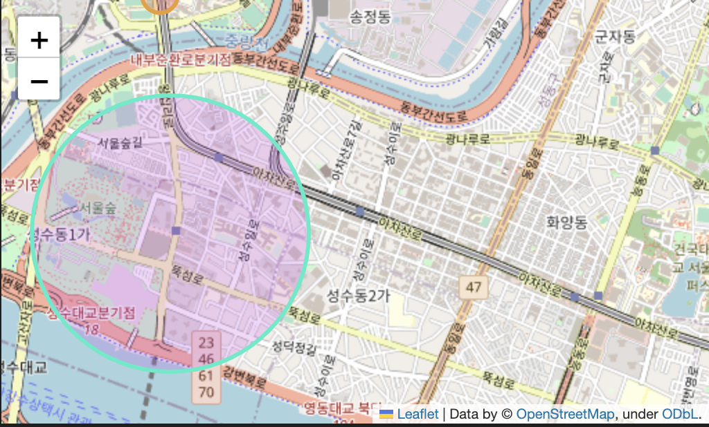
folium.Choropleth
- 주어진 데이터를 polygon 형태로 나타내는 것
m = folium.Map(
    location = [43, -102],
    zoom_start = 3
)

m
fill_opacity: 채우기 투명도line_opacity: 선 투명도legend_name: 범례 이름
folium.Choropleth(
    geo_data = f_path + '02. us-states.json', # 경계선 좌표값이 담긴 데이터
    data = state_data, # Series or DataFrame
    columns = ['State', 'Unemployment'], # DataFrame Columns
    key_on = 'feature.id',
    fill_color = 'BuPu',
    fill_opacity = 1, # 0-1
    line_opacity = 1, # 0-1
    legend_name = 'Unemployment rate(%)'
).add_to(m) # json file : 경계선 좌표값이 담긴 데이터

m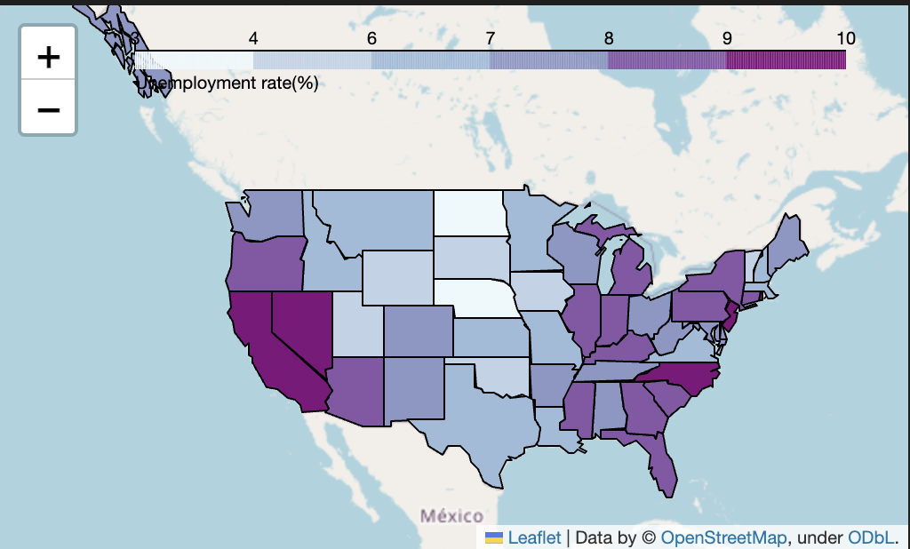

Start